Reasons to oppose the sale
Jun 3
Reasons to oppose Wood Creek sale, Action Items
- During the Covid stay at home order, we are denied meaningful, face-to-face discourse
- City's stated committment to protect urban forest
- Environmentally protected area already suffering from landslides
- Sink Holes in Wood Creek have already destroyed neighbors homes
- Removal of forest will increase landslide risk
- Critical wildlife habitat & public green space should be protected and preserved
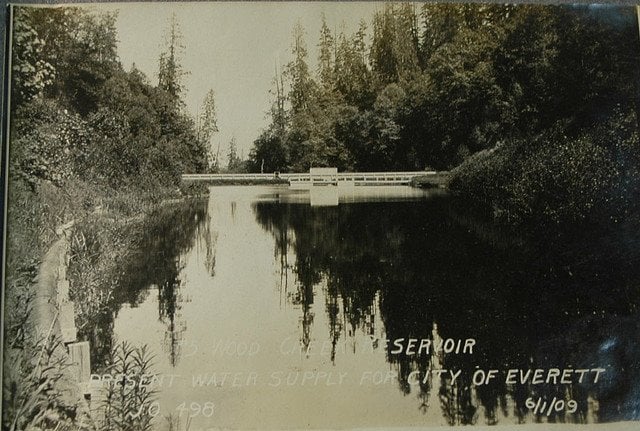
- Wood Creek is the main source of water for Everett's Marshland Tidal Wetland Restoration Project
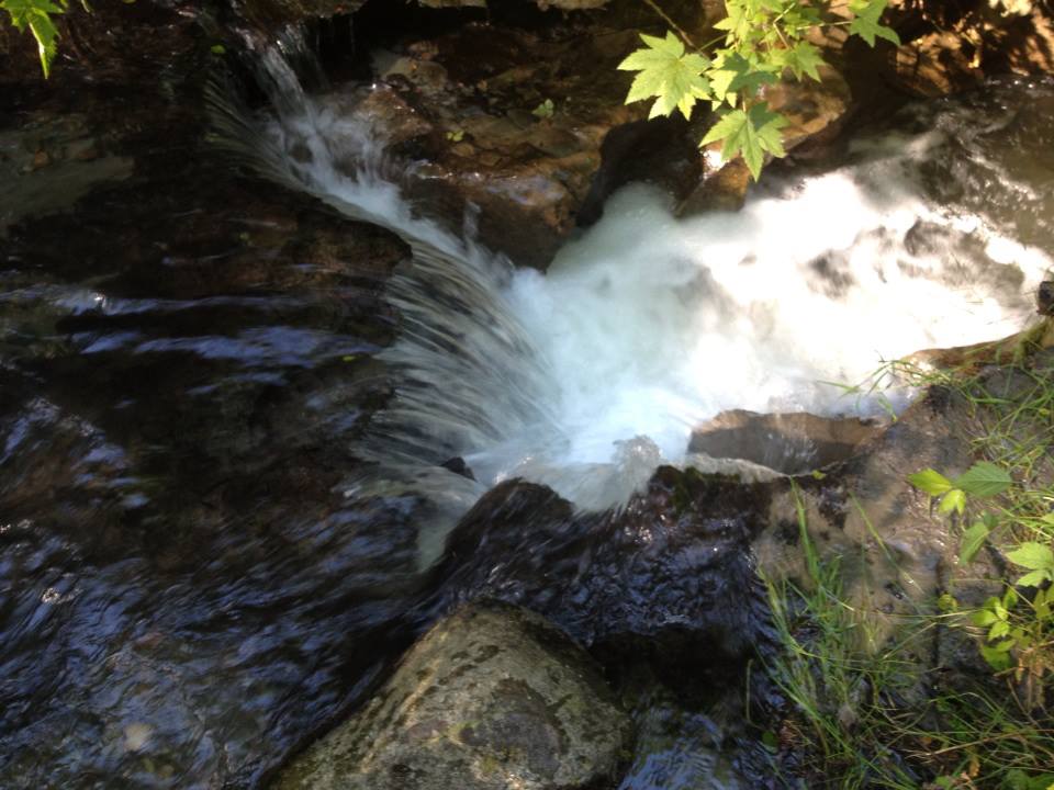
- Preserving the riparian forest will improve water quality
- Keeping the Wood Creek forested corridor intact will improve wild life
- The city has not taken any serious study of existing landslide risks
- Wood Creek is an important historical landmark- it was Everett's original water source
- Access to Valley View is already challenged with one bridge
Related Entries
This entry was posted on June 3, 2020 at 12:59 AM and has received 1258 views.
Comments
There are currently 1 comments.
Download attachment. Show CommentsHigh water saturation on banks where clear cut's occurred
Jun 2
Reasons to oppose Wood Creek sale
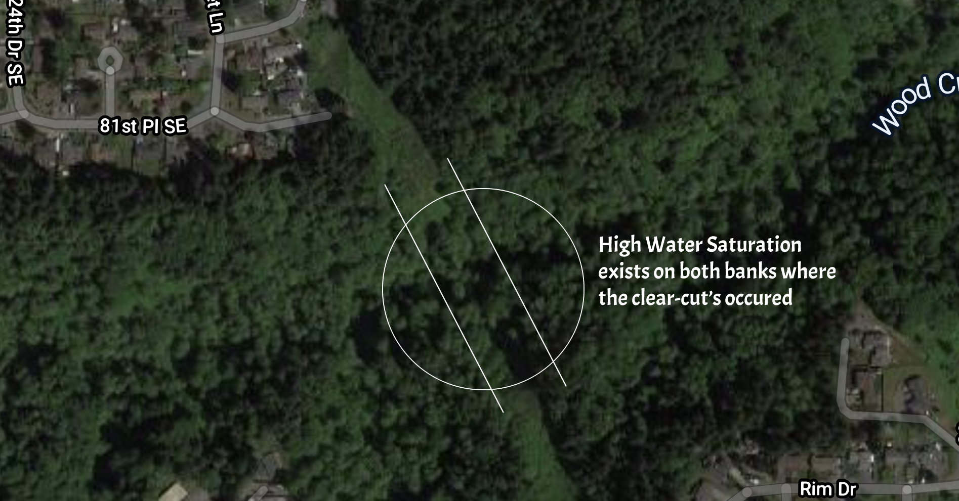
Upon close inspection of both sides of the Wood Creek banks, the most saturated banks in the watershed are right underneath the power lines. The utility company cut the trees on both sides of the bank to allow the wires to cross without impediment from the trees.
The water saturation underneath the power lines is significant up to 200 feet above the valley floor. There is faulting on the northern bank (Valley View), and also several benches with sag ponds filled with sand beneath the wires1.
On the Eastmont side of the bank, two years ago, we lost an entire hill where one of the original Eastmont trails was built to access the creek2. This trail was the favored access point for the Geologist's doing studies down there.
It seems reasonable to conclude that the lack of the forested canopy on both sides of the bank have caused increased water runoff and saturation of the soils here.
Typically, there is much less saturation and erosion of the rest of the watershed as you climb above the valley floor.
1 Oddly enough, the highest sag pond on the northern bank underneath the wires has bamboo growing in it.2 The original trail to the creek that was built near the old Apple daycare facility.
This entry was posted on June 2, 2020 at 1:31 AM and has received 515 views.
Comments
There are currently 0 comments.
Download attachment.Several Valley View Homes fell down the Wood Creek Ravine
May 31
Reasons to oppose Wood Creek sale
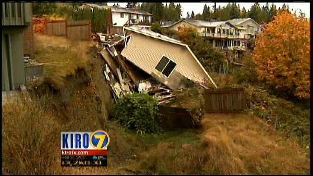
Three houses in the Valley View neighborhood were red-tagged by the city of Everett. One of these three houses slid down the bank, and the others are deemed to be unsafe. The culprit was excess water known as 'Armaggeddon Creek'. The water is racing down the sandy loam soils of the bank, which has up to 40% slope causing landslides.
Here is the excerpt from Kiro7:
"Neighbors in an Everett neighborhood nicknamed "Armageddon Creek" by the people who live there because houses are slipping down a hillside said the city is to blame for the shifting ground.
The shifting hillside is near Panaview Boulevard and Burl Place in Everett.
The stairs on the side of one home that has nearly slipped off a steep hill used to lead to the front door, but now appear to be going nowhere.
Three houses have been red tagged by the city, meaning it is unsafe to occupy the homes. But neighbors claim 10 more houses in the area are in danger.
Video from Chopper 7 showed how the ground is moving and deep cracks opening in the yards and foundations of homes."
See Neighbors blame city for homes sliding off cliff
More news sources concerning 'Armeggeddon Creek'
This entry was posted on May 31, 2020 at 10:18 PM and has received 516 views.
Comments
There are currently 0 comments.
Download attachment.Wood Creek Sinkholes have damaged homes and property
May 30
Reasons to oppose Wood Creek sale
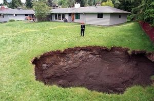
This is a picture of a sinkhole from one of my neighbor's yards. There were a total of 5 sinkholes in these two yards!
The sink-hole was at least 50 feet deep, and it swallowed entire trees, including a classic mustang.
The Valley View side of the bank has more sinkholes than the Eastmont side. I can take some pictures of the existing sink-hole if you think that it may be useful. Here are the relevant past articles found in the news:
This entry was posted on May 30, 2020 at 5:53 PM and has received 570 views.
Comments
There are currently 0 comments.
Download attachment.Recent Comments
|
|
|
|
|
|
|
|
|
|