High water saturation on banks where clear cuts occurred
|
Jun 2 |
by admin
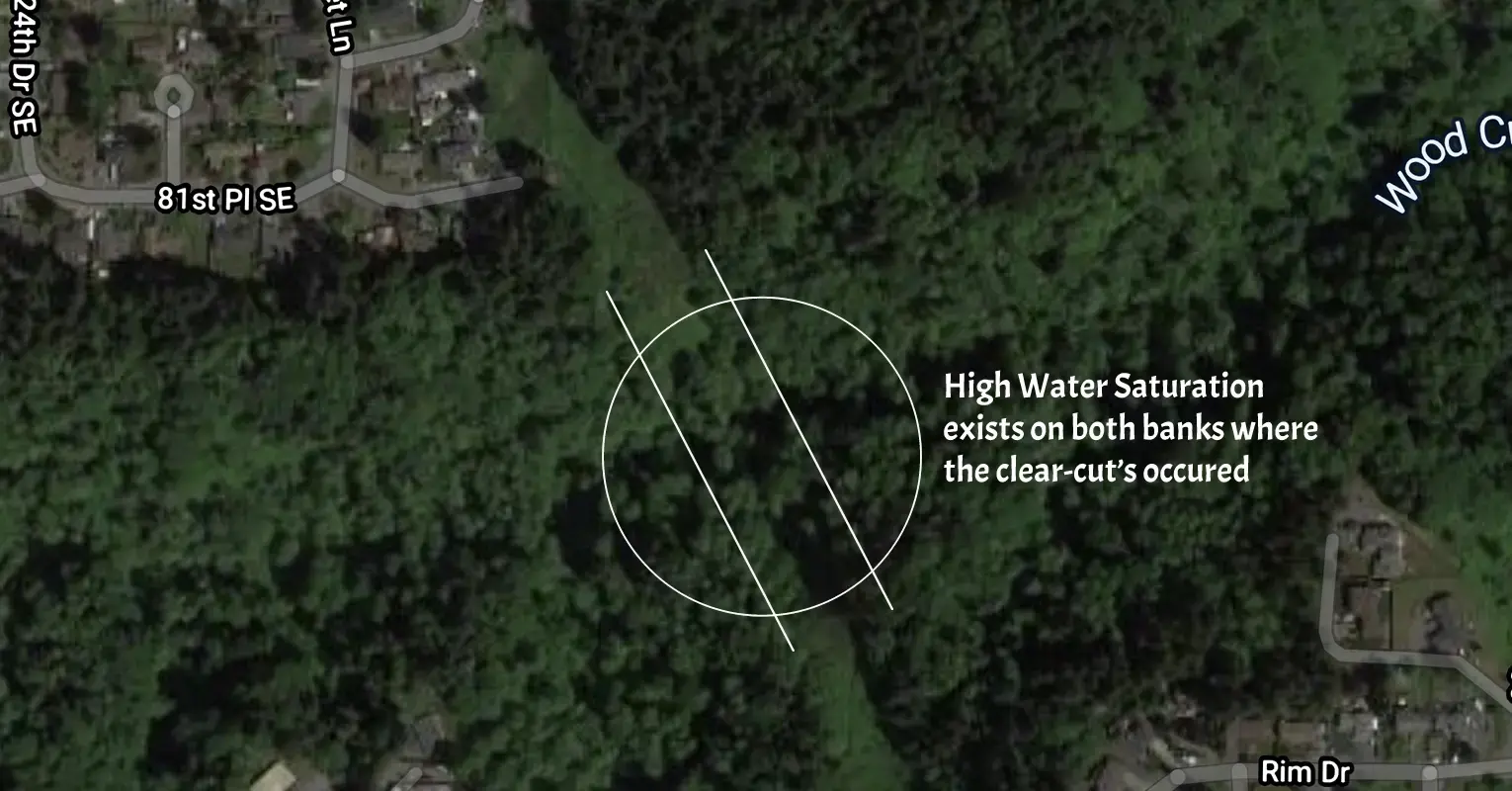
Upon close inspection of both sides of the Wood Creek banks, the most saturated banks in the watershed are right underneath the power lines. The utility company cut the trees on both sides of the bank to allow the wires to cross without impediment from the trees.
The water saturation underneath the power lines is significant up to 200 feet above the valley floor. There is faulting on the northern bank (Valley View), and also several benches with sag ponds filled with sand beneath the wires1.
On the Eastmont side of the bank, two years ago, we lost an entire hill where one of the original Eastmont trails was built to access the creek2. This trail was the favored access point for the Geologist's doing studies down there.
It seems reasonable to conclude that the lack of the forested canopy on both sides of the bank have caused increased water runoff and saturation of the soils here.
Typically, there is much less saturation and erosion of the rest of the watershed as you climb above the valley floor.
1 Oddly enough, the highest sag pond on the northern bank underneath the wires has bamboo growing in it.2 The original trail to the creek that was built near the old Apple daycare facility.
This entry was posted on June 2, 2020 at 1:31 AM and has received 676 views.
Comments
There are 0 comments.