Save the Wood Creek Forest

Forterra's Wood Creek Future Land Use Scenarios Document in HTML
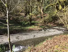
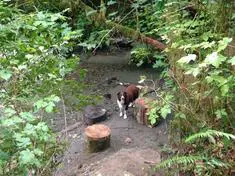
Hi all,

Here is the new official document regarding the future land-use scenarios for the Wood Creek Watershed. However, to read this you must use a PDF Reader.

If you don't have a PDF Reader, you may read the document below. We have done our best to faithfully reproduce the official document from PDF to HTML, however, this document is not complete (it is missing footnotes, images, and appendixes) and it may have some errors.


Wood Creek Future Land Use Scenarios

December 27, 2021 Produced for the City of Everett by Forterra

Contents

  1. Acknowledgements
  2. Introduction and background
  3. Approach
  4. Community engagement summary
  5. Scenarios
    1. No action
    2. Enhancement
    3. Ecosystem services
    4. Partial development
  1. Conclusion
  2. Appendix: overview of funding sources

Acknowledgements

Forterra wishes to thank the following individuals and groups for their input:

City of Everett

  • Councilmember Paul Roberts
  • Deputy Mayor Nick Harper Paul McKee, Real Property Manager
  • Heather Griffin, Surface Water Manager
  • Dan Eernissee, Economic Development Director
  • Yorik Stevens-Wajda, Planning Director

Snohomish County

  • Councilmember Megan Dunn
  • Paula Rhyne, council legislative aide
  • Tom Teigen, Department of Conservation and Natural Resources Director
  • Lacey Harper, Executive's Office

Tulalip Tribes

  • Brett Shattuck, Restoration Ecologist 
  • Gene Enick, Assistant Historical Preservation Officer 
  • Todd Gray

Community groups and individuals

  • Save Wood Creek
  • Paul Benz
  • Erika Rominger
  • Jeff Mallahan, Wetland Resources, Inc.
  • Richard Korf, Trust for Public Lands
  • Liz Johnston, City Forest Credits
  • Joe Sambataro and Vanessa Hague, Forterra
  • Peter Orser, past Forterra board chair and housing advocate

This work was funded by a grant from the Snohomish County Small Capital Projects Partnership program and the City of Everett. Forterra innovates and scales land-based solutions to address the climate crisis and support equitable, green and prosperous communities.

Please contact Nick Bratton, Senior Director of Policy, with any questions about the contents of this report:
nbratton@forterra.org

Introduction

Wood Creek is a utility-owned, forested parcel approximately 92 acres in size located in southeast Everett, of which approximately 10 acres are in unincorporated Snohomish County. The city acquired the property in 1916 as a municipal water source but no longer uses it for this purpose. See following maps of project area for additional detail.

In May of 2020, the Everett City Council held a hearing to consider the surplus of five city- owned properties as part of a strategy to address a structural budget deficit. Wood Creek was among these properties. Following community input opposing this sale, led by the neighborhood group Save Wood Creek, the city withdrew the property from the surplus list. The city and community stakeholders invited Forterra to help identify options for long-term ownership and stewardship of Wood Creek that addressed needs of neighbors and met public revenue objectives. Forterra joined the conversation to facilitate discussions among partners, create a framework for evaluating potential land use decisions, and identify a suite of options for the city to inform a policy discussion on what to do with the property. The partners involved in this effort include the City of Everett, Snohomish County, the Tulalip Tribes, Save Wood Creek, individual community members, and subject matter experts in specialized areas of conservation, restoration, and ecosystem service markets.

Approach

In identifying and evaluating a range of options for the city, Forterra prioritized several principles. First, we wanted the process to be inclusive and collaborative, reflecting the input of the communities that would be affected by any changes to the use of Wood Creek and involving local government and tribal representation from the outset. Second, we identified a shared goal of multiple public benefits. We heard from partners that the best outcome would support a triple bottom line resulting in a healthy environment, budget, and community. One of the central goals of this project was to answer the question: are there options for ownership and stewardship of the property that support the city's budget goals, address community desires, and result in conservation? Third, we heard a desire to inform land use options with an empirical, scientific evaluation of the property. To this end, the city commissioned a geotechnical survey to identify and assess soil types, hazards, and other factors that would influence the potential uses of the property and underpin a subsequent valuation update. Additionally, recognizing that Wood Creek is part of the customary and usual lands of the Tulalip Tribes, we sought guidance from the tribes on pursuing an archaeological study.

Findings from this study will also inform potential land uses. Additionally, Forterra undertook an evaluation of funding sources, programs, and tools that could generate revenue for the city. The objective of this portion of the analysis is to identify and assess the viability of different revenue opportunities that could support a triple bottom line outcome and outline strategies for how Everett might pursue these options. The Scenarios section describes these findings and details on the sources reviewed are in the appendix.

Also of note is prior work. The most recent valuation of the property is an appraisal several years old that estimates the fair market value at $3 million. Absent an updated appraisal it is difficult to estimate accurately the revenue a sale might generate. It is therefore impractical at this point to establish a revenue goal that would replace the city's earnings from selling the property. The framework in the appendix estimates ranges of potential revenues under different scenarios. Additional resources that should inform a policy discussion include existing planning work and obligations under current agreements. These include:

  • Marshland subarea plan. 
    Wood Creek drains to the Marshland Flood Control District and this plan details restoration, infrastructure, and future land use concepts as agreed to by the city under a Shoreline Management Plan with the Washington State Department of Ecology.
  • Marshland tri-party interlocal agreement between the City of Everett, Snohomish County, and the Marshland Flood Control District detailing shared monetary and other responsibilities relating to surface water runoff from areas that include Wood Creek.
  • Snohomish River Watershed Plan is part of the City of Everett's 2017 Surface Water Comprehensive Plan and encompasses Wood Creek, to be updated in 2022.

Any decisions about pursuing future land use actions on the Wood Creek property that might affect existing obligations should be considered in light of these prior agreements.

At the time of this report the city has not yet conducted this survey, pending further direction from council. See Scenarios section for additional information.

Community Engagement Summary

Throughout 2021 Forterra has sought community input on the property. These efforts included convening neighborhood meetings, reaching out to community groups directly, and interviewing local government and tribal representatives. The primary findings from these conversations include the following points:

  • Neighboring residents
    • Are opposed to the sale or development of the property.
    • Are concerned about the natural hazard risk posed by landslides and surface water runoff from surrounding areas, such as roadways.
    • Do not want the city to turn the property into a park.
  • Tulalip Tribes
    • Recognize this property as part of their usual and accustomed areas.
    • Are opposed to the development of the property.
    • Desire access to lands that afford opportunities for cultural activities, however given the urbanized nature and size of the Wood Creek property, it is likely of limited value for hunting, gathering, or other practices.
    • Consider Wood Creek to be a restoration opportunity for salmon and wildlife habitat. It's not a top priority in the context of the broader Snohomish Basin, however they highlight the importance of the creek in the hydrology of the surrounding area. Given the resources and capacity, the tribes would like to pursue restoration of the creek.
    • Prefer to avoid recreation activities, infrastructure, or development that may have adverse effects on the creek's water quality and quantity.

  • City of Everett
    • Is not predisposed to any individual outcome and seeks to consider a range of long-term ownership, use, and stewardship options for the property.
    • Recognizes the importance of conservation values, understands the need to protect environmentally sensitive areas, and respects tribal priorities.
    • Identifies affordable housing as a policy priority of the administration.
    • Values the input of other partners at the table and is receptive to the desires of community members around the property.
    • Noted that creating a park would transfer the property from the utility to the general fund, where it would become a liability and incur further costs in terms of maintenance and infrastructure. This would also generate multiple public benefits and support other goals in terms of expanding access to parks and open space. The city hasn't ruled out this possibility but notes that the option needs careful consideration.

  • Snohomish County
    • Supports a conservation outcome.
    • Supports improvements that align with regional recreational goals.

Based on input gathered through community engagement and research of available funding mechanisms, Forterra identified four scenarios to inform a city policy discussion on what future ownership, use, and stewardship of Wood Creek may include. This section details the mechanics and considerations associated with each of the following scenarios:

  1. No action
  2. Enhancement
  3. Ecosystem services
  4. Partial development

To evaluate each option, Forterra assessed the potential impacts on community, ecology, and economy - the triple bottom line. These findings are made in the spirit of objectivity, with no value statements implied and no recommendations offered. Each scenario has its respective advantages and constraints. Forterra seeks to highlight these to support a robust and well-informed public discourse on the future land use decisions relating to the Wood Creek property.

Scenario 1: No action

This scenario entails retaining the status quo: continued utility ownership of the property in its present state. The city has owned the Wood Creek property since the early 1900s and it wasn't intended to be a revenue-generating asset. As Everett has since established municipal water sources elsewhere, there is no anticipated need for this original purpose.

How does scenario serve:

  • Community outcomes
    • Meets neighbors' desires to retain property as open space.
    • Doesn't address concerns about existing natural hazards and stormwater affecting private property.
    • Access (informal trails) may not align with tribes' desires to avoid impacts that affect water quality of Wood Creek.

  • Ecological outcomes
    • Intact forest provides ecosystem services, however the city does not actively manage the property for these benefits.
    • Supports city's tree canopy goals.
    • Stormwater issues may persist given soil, drainage, and runoff factors.
    • Status quo does not optimize outcomes for fish or wildlife habitat.

  • Economic outcomes
    • Status quo neither generates revenue nor creates a cost to the city in the near term.
    • Keeping the property does not improve the structural deficit issues that the original surplus listing was intended to address.
    • No action may incur costs in the future if stormwater impacts result in degradation or private property risks that the city would need to address

Discussion

Retaining the status quo allows the city to keep its options open. Since the utility doesn't have revenue expectations for the property, there is not a pressing need to monetize the asset for other purposes. The city has incurred costs from the geotechnical survey and additional work will be required to better understand the physical attributes of the property and to establish an updated valuation. No action would preclude further short-term expenditures relating to the property unless and until the city reconsiders its needs for Wood Creek. No action is not a neutral choice, however, as the property has value as open space in its current state and may generate costs for the city in the future if natural processes pose a risk to private property. There is also the question of opportunity cost: what benefits might the city forgo by taking no action in the near term? Additionally, no action affects existing plans and agreements (Marshland subarea plan, Marshland Tri-party Agreement, e.g.) by not taking active steps to reduce surface water runoff that impacts the Marshland Flood Control District.

Scenario 2: Enhancement

This scenario involves the city and partners pursuing funding to pay for improvements to the property that enhance community and ecological outcomes. Examples include grants for natural stormwater infrastructure, riparian restoration, and recreation uses.

How does scenario serve:

  • Community outcomes
    • Meets neighbors' desires to retain property as open space.
    • Could address concerns about hazards and stormwater affecting private property, depending on which improvements city chose to pursue.
    • Expanded access or development of recreation infrastructure may not align with tribes' desires.
    • Recreation is a community benefit identified in existing plans that grant funding could support, however there is mixed opinion among neighbors on the desirability of expanding recreational uses.
  • Ecological outcomes
    • Intact forest provides ecosystem services, however these are not yet quantified.
    • Investing in improvements to natural functions could reduce hazard risk, more effectively handle stormwater runoff, improve fish habitat for recovery efforts and benefit watershed health, including downstream in the Marshlands Flood Control District.
    • Stormwater issues may require investment in natural (or built) infrastructure to adequately address – scale is currently unclear.
  • Economic outcomes
    • Cost implications are unclear. If the city pursues grant funding, it may need to provide a match, depending on the source (see appendix for details on individual funding programs). This could potentially include capital facility expenditures that the city was already planning to make, thereby augmenting existing funding sources. Staff time would be an expense that may not be covered. Another consideration is opportunity cost: if the city pursues work to enhance the Wood Creek property, this limits capacity for other priorities.
    • Enhancements to the property create value for the city, the community, and the environment, however this is difficult to quantify. Investments in stormwater improvements, for example, may avert greater costs later by reducing risks of flooding, landslides, or other natural hazards.

Discussion

A key point in evaluating this scenario is that the Wood Creek property is already considered conserved because it's in public ownership. This limits eligibility for grant funding sources that support conservation of private land at risk of conversion. Another consideration is that the revenue in this scenario must be used for investment and stewardship that would not directly address the city's budget concerns in the short term.

The city's current (through 2021) Parks, Recreation, and Open Space Plan identifies connectivity opportunities to regional trail systems, particularly on the lowland, eastern side of the property. This scenario generates revenue and achieves multiple public benefits, however most funding sources support the completion of improvements resulting in those public benefits. This scenario would involve costs, but could also generate substantial community and ecological benefits, potentially improving the city's and county's resilience by investing in measures that reduce future climate impacts. The Tulalip Tribes expressed a willingness to partner with the city on pursuing restoration activities, highlighting the importance of Wood Creek to the Marshlands flood control district downstream of the property. The appendix includes examples of funding sources, uses, and potential award ranges.

Scenario 3: Ecosystem Services

This scenario involves the city earning revenue by monetizing ecosystem services through active management of the property for specific outcomes. The primary opportunities include selling carbon credits, creating a mitigation bank, and selling development rights.

How does scenario serve:

  • Community outcomes
    • Meets neighbors' desires to retain property as open space.
    • Could address concerns about hazards and stormwater affecting private property, depending on how approach is structured.
    • Tulalip Tribes support ecosystem services.
  • Ecological outcomes
    • Intact forest provides ecosystem services. While these are not currently quantified, this scenario would measure them, monetize them, and result in environmental outcome-based stewardship.
    • Investing in improvements to natural functions could reduce hazard risk, more effectively handle stormwater runoff, improve fish habitat for recovery efforts and watershed health
    • Stormwater issues may require investment in natural infrastructure to adequately address – scale is currently unclear.
  • Economic outcomes
    • Selling development rights would generate the most flexible revenue for the city, albeit less than an outright sale of the property.
    • Carbon credits could be a source of revenue if Wood Creek was part of a larger carbon strategy for the city, however public ownership status may constrain this option.
    • Wood Creek could serve as a mitigation bank if part of a larger mitigation strategy for the city.

Discussion

Forterra reviewed three ecosystem service programs that could potentially apply to the Wood Creek property. These include the creation of a mitigation bank, the sale of carbon credits, and the sale of development potential through the city's transfer of development rights program. As a general statement, some of these options would be viable revenue sources for the city, however they involve varying degrees of complexity, uncertainty, and return on investment.

Revenue from these programs is generally intended for improvements to and stewardship of the property, however not all have requirements for how funds must be used. Some generate flexible revenue that the city could direct to a wider range of purposes. Of these three options, sale of carbon credits and sale of TDR credits appear to be the most feasible in the short term, however the revenue potential is unclear absent more detailed findings from the geotechnical survey and an updated appraisal. Eligibility is also a potential limiting factor in certain cases since the land is publicly owned. Although the current market for TDR is not strong on the demand side, this tool could potentially pair with the Partial Development scenario.

Mitigation bank

A mitigation bank is a wetland, stream, or other aquatic resource area that has been restored, established, enhanced, or (in certain circumstances) preserved for the purpose of providing compensation for unavoidable impacts to aquatic resources permitted under the Clean Water Act Section 404 or a similar state or local wetland regulation.3 Examples of existing mitigation banks nearby include the Critical Areas Mitigation Program in Mukilteo and the Snohomish Basin Wetland Mitigation Bank.4 Findings from interviews with a wetland mitigation bank designer suggest that creation of a mitigation bank on the Wood Creek property would create value for the city in that it could use the property to offset its own impacts on capital facilities projects elsewhere. The creation of a mitigation bank would take approximately three to five years and involve partnerships with state and federal agencies. This option would be more attractive if the scale of the bank was larger than the 92 acres of Wood Creek. While potentially feasible as part of a larger network of properties, the city already has a mitigation bank project in place. According to city staff, Everett's existing Smith Island Advance Mitigation Service Area has generated more restoration credits than the city anticipates needing in the foreseeable future. Unless future land use patterns change such that the city requires more mitigation credits, this option may not create value in the short to medium term.

Carbon credits

Everett is potentially eligible to pursue a carbon project through the City Forest Credits program. As in the Enhancement scenario, public ownership of the property may limit the viability of a carbon project. In other respects, however, Wood Creek meets criteria for issuing and selling carbon credits. If approved, the property would most likely qualify as "forest preservation within an urban area." Initial assessments suggest that Wood Creek satisfies many of the requirements for a carbon project, however further work would be needed to detail the exact steps to create a project and estimate revenue potential. City Forest Credits reports that local projects selling credits have recently seen prices range from $22 - $30 per ton and a rising demand for carbon credits is anticipated over the next few years. While there are no explicit constraints on funds generated through sales of carbon credits, best practices involve acquiring additional lands at risk of conversion, investing in forest health, or similar steps.

Everett could potentially scale a carbon project on Wood Creek as part of a broader portfolio with other city-owned open space. In entering a commitment for a carbon project, the city would need to guarantee preservation of trees for 40 years and would need to conduct monitoring and reporting. Other cities have successfully created carbon projects on publicly owned land, such as Portland, however these have been on a larger scale (hundreds and thousands of acres).

Transfer of development rights

Everett has an intracity transfer of development rights mechanism in place. Defined as a reasonable use exception, this process allows property owners to sell unusable development potential in the form of credits that can then be used to achieve higher intensity development on properties better suited to growth elsewhere in the city. Everett municipal code does not expressly define constraints on ownership of properties eligible to sell development potential.

Forterra and city planning staff interpret the code's intent as not disallowing public land from participation in this TDR provision. Data from program activity history shows that it has only been used seven times since its inception, suggesting that demand for city-owned credits on the open market would be low. Even if the city determined eligibility for sale of development rights from the property, it's unlikely that the market value of those credits would approach the revenue potential from selling the property outright.

The city could combine the use of TDR with the Partial Development scenario, effectively shifting development potential from one portion of the property (and thereby conserving it) to another part of the property in accordance with code. The city would have discretion for how to use the proceeds from a TDR credit sale, as code does not identify restrictions on this point.

Scenario 4: Partial development

Initial geotechnical survey findings show that two portions of the property are comparatively flat. Further analysis will determine exactly how much of the property could be developed, but for the purpose of this exercise the assumption is that some level of development would be possible. The city would make a policy decision on how much of the potentially developable land could be converted, how, at what intensity, and under what conditions. For example, one possibility would be that the city allows development of seven acres at some increased density in exchange for payment from the developer and placement of a restrictive covenant on the balance of the property with development potential.

How does this serve:

  • Community outcomes
    • Neighbors are opposed to development.
    • Tribes are opposed to development.
    • Existing infrastructure and access to the neighborhood are limited.
    • Development of affordable housing would support a city policy goal, recognizing that this benefit may have other impacts.
  • Ecological outcomes
    • Development increases the risk of impact on stormwater, creek health, natural hazards. Water quality and quantity are important considerations for watershed health as the Marshlands flood control district immediately downstream of Wood Creek is already under strain.
    • Conversion would result in loss of tree canopy, which does not support citywide goals on tree canopy and retention, as well as Everett's climate action plan.
  • Economic outcomes
    • Sale of property could result in affordable housing, low-impact development techniques, investment in property improvements (restoration), could reach city revenue goals depending on terms.
    • City would be required to sell property at appraised value to avoid a gift of public funds unless it sells for the purpose of affordable housing, in which case the city can sell at below-market value.

Discussion

This scenario has the potential to address two public priorities: making progress towards remedying the structural budget deficit and providing affordable housing. As a general policy position, the City of Everett recognizes the current and future need for housing to accommodate a growing population. The regional growth strategy, VISION2050, highlights the importance of growth in cities where it can be more efficiently served by infrastructure, transit, access to jobs, schools, parks, and other attributes that make for welcoming, affordable communities. In its forthcoming comprehensive plan update, Everett will update its growth targets that require the city to plan for population and employment increases over a 20-year timeframe. In light of this local and regional growth context, Everett may contemplate housing as a future use for any publicly owned property.

The city is required to sell the property at fair market value (to be established by updated appraisal) unless the end use is affordable housing. The local community and Tulalip Tribes oppose development - converting forest to residential uses has the potential to create adverse impacts. Opportunities for infill development exist elsewhere in the city in locations that are well suited to the purpose and would be more valuable for sale. For example, the city owns multiple properties neighboring the Everett transit center that could be redeveloped with buildings in the height range of seven to 12 stories.6 The Wood Creek property is currently covered by mature forest and removal of trees for development would not support the city's tree retention goals. Absent an updated property valuation and further geotechnical study, it's difficult to anticipate how much development is possible and what the revenue potential is to the city. Further work in this area will provide a clearer picture of potential uses and valuation.

Developing only a portion of the property would lessen impacts and, depending on the design of the project, could result in conservation of (or improvements to) the balance of the property. Approaches the city could take to achieve this outcome include:

  • Pursuing a developer agreement for a portion of the buildable area to include low-impact design, stormwater mitigation, and additional public benefits, or
  • Using the intracity transfer of development rights program to achieve higher densities on one portion of the property by shifting development potential from another, or
  • A combination of these two.

Conclusion

Of the scenarios identified here, each offers advantages and involves tradeoffs. The primary factors influencing the viability of any course of action include:

  • the constraints on the property conferred by public ownership,
  • the need for greater certainty on how the property's physical characteristics affect potential uses and valuation through further geotechnical study,
  • existing city plans and agreements relating to the Wood Creek property and its interconnectedness with the Marshland Flood Control District, and
  • community support for a conservation outcome.

Everett's original motivation for listing Wood Creek as a surplus property was to generate revenue. Other than the No A

This entry was posted on July 18, 2022 at 1:50 AM and has received 320 views.

Comments

There are currently 0 comments.

Download attachment.

City of Everett Future Land Use Scenarios

Hi all,

We were just given a new official document regarding the future land-use scenarios for the Wood Creek Watershed. The SWCE group has been discussing these options and we will post more here soon.

Here is the official document regarding the future land use scenarios that we have just received. This document is a pdf and you will need to use Adobe Acrobat or another pdf reader to view the document.

The document can be found at https://savewoodcreek.org/documents/WoodCreekLandUseScenerios.pdf

This entry was posted on July 7, 2022 at 2:59 PM and has received 346 views.

Comments

There are currently 0 comments.

Download attachment.


Stewards of Wood Creek Everett Mission

To protect and preserve the Wood Creek forest for future generations through conservation and stewardship.

Footer Logo The City of Everett has proposed the sale of about 92.5 acres of undeveloped green belt property. Wood Creek lies in the valley between the Valley View and Eastmont neighborhoods. Wood Creek was the main source of drinking water for the city of Everett between 1898 and 1916, until the Sultan River water project was completed. The land and the creek is a critical habitat for a variety of animals and wildlife. Additionally, the land is unstable and many parts of the land are critically sloped. This group is for anyone opposing this proposal and for trying to preserve this critical land.


Everett's Original Watersource: Main Wood Creek Reservoir in June of 1909.

Everett's Original Watersource

Galaxie Blog Version 1.50 November 22 2019 © Gregory Alexander